Have you ever followed a highway sign and gotten nowhere? Follow some directional markers off Northwest New Jersey country roads and that's just what you'll get. Unless of course you slow down long enough to take a closer look. A few older homes clustered together, a crumbling foundation, cemetery stones worn with time: these places tell stories worth knowing.

Huntsville, a part of Green Township in Sussex County, is such a place. Drive down State Route 206 in Andover or County Route 519 out of Johnsonburg, and you'll see signs for Huntsville. Follow them, and one will not, at first glance, be rewarded with a town. There is no post office, general store, fire station, or church. Unlike neighboring Allumuchy, Tranquility, or Greendell, Huntsville no longer retains any of these prerequisites for civilization. Yet upon closer inspection, those old buildings, now private homes, hold clues to the town which once thrived. Step back in time, just a mere fifty years, and the town of Huntsville exists again.
Huntsville is situated along the Pequest River and lies within the area known as the Pequest Valley. These ninety-one acres, purchased by Thomas Wolverton in 1750, were strategically surveyed to include the main road between New York City and Easton, Pennsylvania. Here, where the river and the road intersect, beat the heart of downtown Huntsville. The river itself gave life to the town by offering the high banks needed to build a large earthen dam and millpond, allowing the power of the flowing water to be effectively channeled and utilized. Mr. Wolverton's first commercial endeavor, a unique bloomery forge, used a waterwheel to power a bellows to blow air into a very hot fire and work super-heated iron ore into a white-hot mass known as a "bloom". A hammer, also powered by the waterwheel, then shaped the ore into a bar while pounding out any impurities. Although Wolverton's venture eventually failed, it demonstrated that the iron ore in the area was of good quality, and helped to establish the development of the mining industry in neighboring Andover.
Wolverton also built a tavern and inn, which in 1756 served as the location for the Sussex County Court. But courts were routinely unable to meet due to ongoing Indian hostilities, part of the French and Indian Wars. The Delaware Indians were angered over a land purchase brokered by the sons of William Penn. While the land in question was on the Pennsylvania side of the Delaware River, hostilities eventually spread to Northwestern New Jersey. The Treaty of Easton in 1758 ended these hostilities, and by the turn of the century the town's population had grown. It now boasted a four-story gristmill, a sawmill, a blacksmith, a general store, a yellow ware pottery, and even a school.
The first recorded name for the town was Pettit's Mill in the late 1700s, even though its actual boundaries were disputable. When Wolverton bought his ninety-one acres there was a boundary line between East and West Jersey. Surveyed in 1743 and known as the Lawrence Line, it ran from Little Egg Harbor north-northwest to the Delaware River using trees as markers. Wolverton conveniently relocated part of his West Jersey purchase to include prime land along the Pequest River, which lay in East Jersey territory. Further complicating the situation, in 1840, the western part of the land briefly became known as Maxville and even had its own post office.
To this day, the actual municipal boundaries are fuzzy, but wherever they are, the town became known as Huntsville in the early 1800s, when Judge Abraham Hunt came into possession of the gristmill property. Thriving by mid-century, there were numerous general stores, including two reputed to be the best in the region. The 113th Infantry Division of the United States Army held practice drills and had a permanent camp in the fields of Huntsville. A blacksmith, gristmill, sawmill, wheelwright, and even a creamery were in operation by the end of the century.
In 1908, the railroad came to town. The Lackawanna Cutoff was built to provide a direct route from Port Morris to the Delaware River. It was built without elevation changes, requiring the construction of the Pequest Fill. Three miles long and up to one hundred and ten feet in height, this artificial ridge runs alongside the road through Huntsville. Hundreds of skilled and unskilled laborers were needed to complete this portion of the Cutoff. Huntsville provided the services they needed.
The railroad built a barracks camp for skilled labor in the cornfields surrounding downtown. The unskilled workers were housed in boxcars on what is now a dairy farm on Route 603. In 1908, a multipurpose building was built downtown to meet the needs of the railroad workers. It served as a rooming house, post office, general store, and poolroom. This building was built over a spring, which served as its water supply and as a means of refrigeration. Sidewalks and street lamps were erected, and the town prospered. The railroad, having demolished the old schoolhouse that sat in its right-of-way, built a new brick schoolhouse that stands to this day.
The workers left in 1911 when their job was done. The general store and post office, in the 1908 building, continued to operate until 1922, as did the school. The sawmill met its demise, replaced by a residence built on its foundations in 1937. The gristmill was demolished in 1938 and the grind wheel was buried to make way for school bus garage. The sidewalks and street lamps were removed, as were all but one of the railroad barracks. The immensity of the Pequest Fill now dominated the landscape, as passenger and freight trains passed high above the town along the Cutoff.
But all was not yet lost for Huntsville. The WPA (Works Progress Administration) constructed a town swimming pool along the river in 1937. The 113th Infantry still drilled nearby and routinely took advantage of the pool. (The army camp was very recently demolished and a new home built at the site.) The United States Geological Survey built the Huntsville gauging station in 1932 to measure the flow and the depth of the Pequest River. The road was paved in 1940, and the old steel truss bridge over the Pequest replaced around 1970. But the decline in population and businesses had changed the character of Huntsville from a bustling downtown to a small residential enclave. The last blacksmith closed shop in 1957. The passenger train stopped passing through in the 1960s, and freight line was discontinued in the 1970s. The rails on the Cutoff were dismantled a decade later.
Today's downtown Huntsville holds many reminders of its past. The original forge and the stone Wolverton house from 1750 are still here. There is an intact limestone kiln, a rarity today as most in Sussex County have been destroyed. These stone structures were used to burn the abundant limestone into ash, which was used to fertilize the fields as well as to mix into a mortar for building purposes. The boyhood home of Henry Kelsey, former Huntsville storekeeper and NJ Secretary of State from 1870-1897, stands today. The 1908 "multipurpose" building is here as well, as is the 1908 schoolhouse. So are the Northrup House and the Titman homestead, both well over one hundred years old. The remaining barracks house stands, as does a Sear's catalog home from the 1800s. The cemetery, long out of use, is the final resting place of Luther Hill, the first superintendent of Sussex County schools. Civil War veterans and railroad workers are buried alongside the town's past residents. The ruins of the swimming pool and the original earthen dam built to power the forge remain. And the silent yet majestic presence of the Pequest Fill quietly continues to dominate the landscape surrounding Huntsville. The current residents are now the privileged caretakers of over two hundred and fifty years of Huntsville's past. When you're passing through, slow down and take a look.
The brief quarter-mile of downtown Huntsville lies along Pequest Road, reachable via Route 611 in Green Township. After passing under the railroad tunnel, note the Pequest Fill passing in and out of view on the right. On the left, look for the limestone kiln, which marks the entrance into downtown Huntsville. Next, the Kelsey House, the Wolverton Stone House, and the house built on the sawmill foundation lead to the river. Note the gauging station. The 1750 forge stands on the banks, followed by the "multi-purpose" 1908 building, the Sear's catalog home, and behind it the railroad barracks house. On the right, the farmhouse dates back to the 1850s and once was a store. The next house, the Titman homestead, is equally as old and was the site of the last blacksmith shop. Straight ahead on Sutton Road is the Huntsville Burial Grounds, and the Northrup house across the road. The enormity of the Pequest Fill is now directly in front of you. As the road bends left, note the red brick schoolhouse. At the stop, make a right and pass under the railway Cutoff once again. The industrial building on the left was the site of the creamery, and the dairy farm was once the site of the boxcar homes for the railroad workers.
Richard Vohden, Huntsville resident and unofficial historian, graciously provided access to extensive documentation and research pertaining to Huntsville. The following sources were invaluable in researching this story:
Peters Valley shares the experience of the American Craft Movement through interactive workshop learning through a series of workshops. A shop and gallery showcases the contemporary craft of residents and other talented artists at the Crafts Center...ceramics, glass, jewelry, wood and more in a beautiful natural setting. Open year round. Closed Thursday.
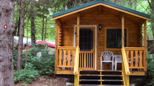
Located in Sussex County near the Kittatinny Mountains the camping resort offers park model, cabin and luxury tent rentals as well as trailer or tent campsites with water, electric and cable TV hookups on 200 scenic acres.
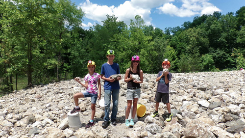
“The Fluorescent Mineral Capitol of the World" Fluorescent, local & worldwide minerals, fossils, artifacts, two-level mine replica.
Follow the tiny but mighty Wallkill River on its 88.3-mile journey north through eastern Sussex County into New York State.