On a scorching, 95-degree day of high humidity, Martin Diamant and Nick Guarracci of South Plainfield emerge from the shady cover of the Raritan River’s North Branch. Fishing poles in hand, they cross the intersection of Routes 512 and 202 in Far Hills. Seven plump, brightly speckled trout dangle from a string.
If, to paraphrase an old Chinese saying, the mark of a successful man is the ability to spend an entire day on the bank of a river without feeling guilty, Martin and Nick have succeeded brilliantly. They hold up the fish for inspection. Three hours of work, plus the cost of their gear, licenses, and a supply of mealworms represents time and money well spent.
“Nothing beats a day of trout fishing on the North Branch,” Martin claims. The guys grin.
Their luck had held throughout the morning. Somerset County’s rivers also draw families, nature lovers, pet owners, and picnickers to their banks. Children splash through the rocky riverbeds. Birders amble along the shores. The two fishermen had enjoyed three hours of solitude on a precious stretch of public river frontage.

Two tributaries of the Raritan River, the Lamington River and the North Branch, meander through some of the prettiest scenery in the state. They are the result of still other tributaries, streams and creeks and wetlands that traverse the countryside and vanish into the domain of estates that speak of privilege and privacy. From the ground it is difficult to visualize how many brooks and streams zigzag through the land. On sunny days, an aerial view of green fields and horse farms, delineated by streams, reveals a mosaic effect, like the tracings of metal around stained glass. Still, to drive along roads that follow the twisting path of the water is to discover vistas of tree-lined riverbeds, small waterfalls, and ruined mills. At one particularly pretty spot on Rattlesnake Bridge Road, a stucco home, perched on a craggy bluff, looks down into the shallows of Lamington River. Happily, some of the best stretches of the rivers are now open to the public. Confucius claimed that a man of wisdom delights in water; these havens offer ample opportunities to grow wise.
Moving south through Somerset County and into the eastern edge of Hunterdon County, the Lamington River (known as the Black River north of Pottersville) draws water from streams and creeks of the Upper Raritan Watershed.
To learn about the importance of this river system, visitors can stop in the Fairview Farm Wildlife Preserve in Bedminster or the Whittemore Wildlife Sanctuary in Oldwick. Fairview, the headquarters of the Upper Raritan Watershed Association (urwa.org), is a naturalist’s delight. A combination of woods and wetlands, the preserve’s 170 acres include pond-fed streams, one of which flows into the Lamington. Programs designed to “increase environmental awareness throughout the watershed region” attract children and adults and range from summer day camp to advice for property owners and municipal planning boards.
Adopting a somewhat lower profile, the Whittemore Wildlife Sanctuary offers trails for hiking, horseback riding and dog walking throughout its 180 acre parcel, part of which nestles against Rockaway Creek. Whittemore also hosts a variety of programs in environmental education, encouraging appreciation for the river system and its wetlands.
Lamington and its tributaries also teach history. Leaving Whittemore, drivers who turn west on Rockaway Road soon cross a small cascade. On the other side of the intersection, vegetation creeps around the ruins of Colonel John Taylor’s gristmill. This is Taylor’s Mill Historic District, where a sign on a bridge farther up the road provides a brief sketch of the sentiments of the English settler who built the mill: “Mill supplied flour to American troops during the Revolutionary War and continued to operate into the early 20th century.” More evidence of early American history abounds; looping back up to Pottersville, a village listed in the National Register of Historic Places, the curious can still find evidence of the region’s agrarian roots. The Lamington Historic District, which includes Lamington and Black River Road, as well as Rattlesnake Bridge, offers examples of Queen Anne and Greek Revival architecture. Above all, the districts provide opportunities to appreciate the impact of the river on its towns.

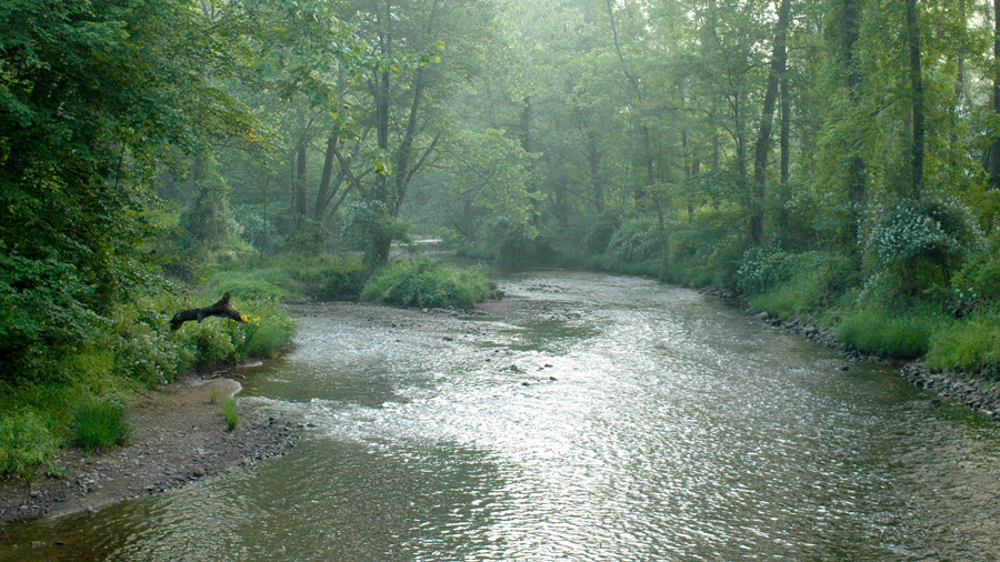
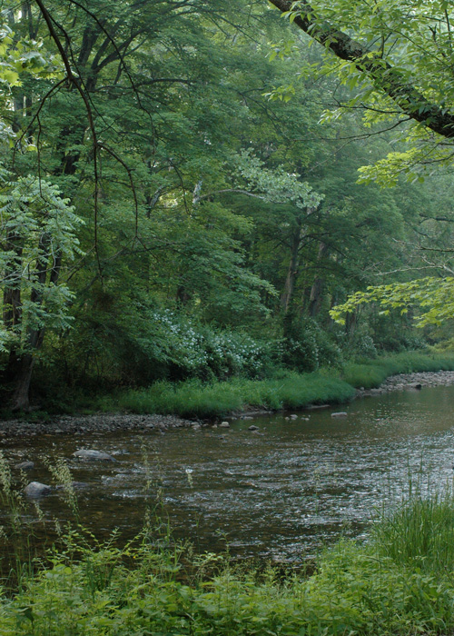
The river itself—broad, clear, rippling over rocks and a haven for fish and wildlife—warrants recognition. The National Park Service gives the river an “r” rating, to whit: the river possesses recreational opportunities that can draw visitors from long distances. Activities might include “sightseeing, wildlife observation, camping, photography, hiking, fishing and boating”, while “interpretive opportunities may be exceptional…” Here one can learn to kayak, to identify wetland plants and to read animal signs, which might include those left by coyote and bear. Not all land is private. Public spaces dot much of the river’s length as it journeys into Bedminster and passes Fiddler’s Elbow Golf Course, its volume aided by tributaries until it merges with the waters of the North Branch.
The North Branch begins as a stream in Morris County. By the time it reaches Somerset County, aided by water from various tributaries, the river broadens and becomes a wide channel. In periods of heavy rainfall, the North Branch overflows its banks. In 1999 floodwaters from Hurricane Floyd inundated the hamlet of North Branch. Buildings in the village now perch on cement blocks. (Development exacerbated the problem, but flooding is not new; the Raritan’s name comes from an Algonquian word meaning “stream overflows.”)
Most summer days, however, the Raritan’s tributaries offer benign delights. Over four decades, conservation efforts have led to the acquisition of almost 3,000 acres in an area designated as the Black River Greenway. Some of that acreage is nothing short of spectacular.
Off Peapack Road in Bedminster Township, a small gatehouse marks the entrance to Natirar, the former estate of the late King of Morocco. Managed by the Somerset County Parks Commission, the 411-acre park opened to the public in the spring of ’07. Visitors park by a set of barns and follow a walking trail down to the river. The river has always been an integral part of the property, so much so that the original owners took its name for their vast estate. Natirar is Raritan, spelled backwards.
Coiling through Natirar, the river marks the boundary between the park’s public and restricted lands. A footpath, protected by shade trees, follows the right bank. Wildflowers grow in profusion on the opposite shore. The river is best enjoyed on foot, or seated at the base of a large tree. Its shallow, rocky bed discourages swimming, which is not allowed in any case. Fishing is also forbidden, pending an ecological assessment by New Jersey Fish & Wildlife, which includes temperature testing and a survey of biological markers that, hopefully, will indicate clean water for stocked trout. Meanwhile, the park offers moments of serenity and natural wonder. Its rippling current could provide the sound track for a calming, sleep-inducing CD. On a recent visit, a woman pushing a baby carriage startled a pileated woodpecker that winged off through the trees.
Natirar also provides important watershed protection for the North Branch, before the river flows south through Somerset County. A short distance downriver, the water sees more active use. Along Route 206, sharp-eyed drivers will spot telltale signs of parking, as well as footpaths through dense saplings. The paths lead down to the river, although easier access can be found a few miles to the south. The less intrepid can drive to the village of North Branch, where the North Branch and Lamington have merged. Visitors can park near the bridge by the intersection of Route 28 and Milltown Road. Early on a weekend morning, quiet descends over the village. On the bridge, words by A.A. Milne, from Pooh’s Little Instruction Book, might come to mind: “Sometimes, if you stand on the bottom rail of a bridge and lean over to watch the river slipping slowly away beneath you, you will suddenly know everything there is to be known.”
Even if universal knowledge proves elusive, the widening river can still teach. Pedestrians are sometimes surprised by the unexpected appearance of an American eel that hides just upstream, under an uprooted tree. Northern water snakes – frequently mistaken for poisonous water moccasins – undulate with the current. Catfish lurk under rotting logs; crayfish scuttle across the muddy bottom. At North Branch, where the current often pushes against the fishermen standing mid-channel, the river commands respect. Deep holes can catch waders; it is not a place to play barefoot in the water. The current sends canoes skittering sideways, to grind up against raised gravel beds. In times of low water levels, however, children in flip-flops and sneakers still hunt for frogs, minnows and fresh water mussels in shallow channels. The river flows under route 22 and down to the 185-acre North Branch Park, headquarters of the Somerset County Park Commission. The serenity offered by the North Branch becomes increasingly precious. A short distance later, it merges with the South Branch to form the Raritan River, that winds through congested cities and out to the bay.
Even today, if you needed a natural hideout—a really good one—Jonathan’s Woods could work.
The Jacobus Vanderveer house is the only surviving building associated with the Pluckemin encampment.
Paths of green, fields of gold!
The Millstone Scenic Byway includes eight historic districts along the D&R Canal, an oasis of preserved land, outdoor recreation areas in southern Somerset County
Part of the Morristown National Historic Park, the formal walled garden, 200-foot wisteria-covered pergola, mountain laurel allee and North American perennials garden was designed by local landscape architect Clarence Fowler.