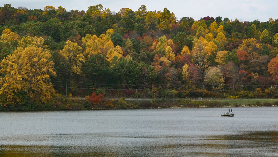
Warren County, New Jersey, offers a wide range of recreational opportunities for all kinds of people. Outdoor lovers enjoy rigorous hikes, abundant wildlife and superb scenery. For those who favor history, the river valleys become avenues marked by eight thousand years of human endeavor from the initial Lenni Lenape habitation, through the days of Colonial settlement, to the heady times of the Morris Canal and the great railroads. Others come to savor classic architecture and country hospitality in the small villages. All agree that Warren County’s rural nature is the key to its allure.
| 1 | Appalachian Trail (AT)Rt. 80 parking area |
More than seven miles of the AT within Worthington begins in a stretch to Sunfish Pond, then beyond to Millbrook Road with spectacular views. More... |
|---|---|---|
| 2 | Dunnfield CreekRt. 80 parking area |
3.5 miles to Sunfish Pond through a gorgeous ravine, accentuated by serene pools and glorious forest, readily combined in a loop with the AT. More... |
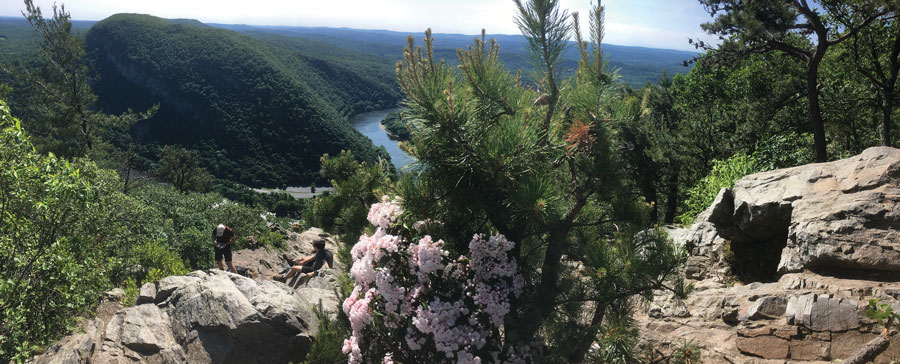
| 3 | Red DotRt. 80 parking area |
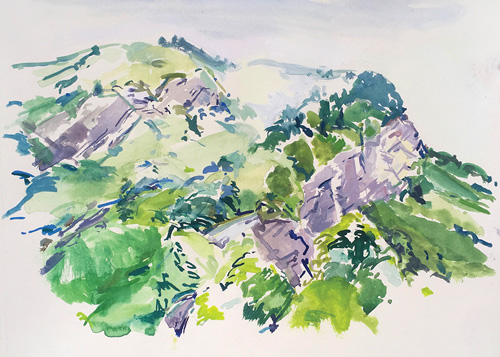
This 1.2 mile steady ascent traverses rocks and boulders leads to the top Mount Tammany with a panoramic view of the Delaware Water Gap at an elevation of 1,201 feet. More... |
| 4 | Blue BlazeRt. 80 parking area |
This 1.7 mile trail to the Tammany summit might be considered as a more gradual portion of a three-mile loop hike in combination with the Red Dot. More... |
| 5 | KaramacOld Mine Road |
Paralleling the Old Mine Road just north of the Gap, this former railbed along the river provides a short taste of days past in a beautiful setting, as one section passes through the site of a former resort. More... |
| 6 | Farview (Beulahland)Old Mine Road |
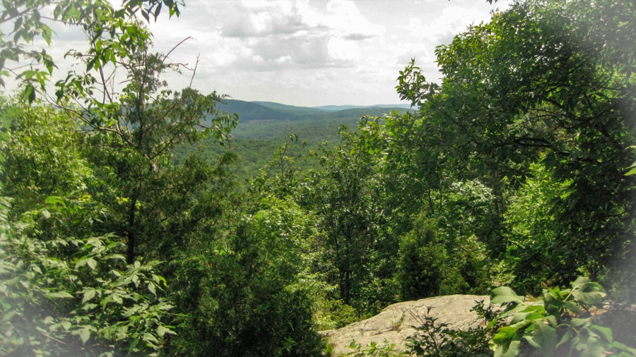
An antique mountain road, the 1.3-mile trail heads up and over the mountain, passes by an old home site or two and eventually meets the Appalachian Trail. More... |
| 7 | DouglasOld Mine Road |
A mile up the road from State Park headquarters is the trailhead for a 2.5-mile long uphill path named in honor of Supreme Court Justice William O. Douglas for his part in helping to save Sunfish Pond’s natural character. More... |
| 8 | RockcoresOld Mine Road |
The 2.7-mile trail zigzags up the mountainside where still-visible borings were extracted to determine what rock layers lay beneath to test the mountain’s suitability for the ill-fated Tocks Island project in the 1960s. More... |
| 9 | KaiserDEWA, Old Mine Road |
The 2.1-mile trail is a steep ascent to the AT near Yard’s Creek reservoir. |
|---|---|---|
| 10 | Coppermine TrailOld Mine Road |
The 2-mile trail passes the Dutch mines dating from the 1600s for which Old Mine Road is named, through a hemlock ravine and stream, terminating at the AT, just south of the Mohican Outdoor Center. |
| 11 | Rattlesnake Swamp |
Beginning at the Mohican Outdoor Center, an old camp now operated by the Appalachian Mountain Club, the trail combines with the AT in a 4.8-mile loop around the Rattlesnake Swamp. |
| 12 | Van Campens GlenOld Mine Road |
A short dirt lane leads to a picnic area from which hikers can follow the naturally sculpted streambed of Van Campen's Brook into the Glen. Or continue to a small marked roadside parking area a little further up to hike down the glen. Either way will yield beautiful views along one of the nicest paths in New Jersey. |
| 13 | Jenny Jump Trailbegins at State Park Road southwest of the park office |
The 8.6-mile cross country trail through forest travels south along a series of ridgelines. At Lake Just-It, the trail turns west and intersects with Mountain Lake Trail which leads downhill to the lake. |
|---|---|---|
| 14 | Summit Trailbegins near park headquarters |
|
| 15 | Ghost Lake Trailbegins at Shades of Death Road, Great Meadows |
The 1.8-mile trail follows the south side of the lake, then proceeds uphill to old cabin eventually meeting the Summit Trail. Evidence of Indigenous occupation has been found at the “Faery Hole” in that vicinity. |
| 16 | Deer Path TrailAllamuchy Deer Park section, a large elevated section of the park bounded by I-80, Waterloo Road, and Route 517.Trailhead on Deer Park Road off Route 517. |
The 6.5-mile loop trail connects to the Lake View and Barberry trails around Deer Park Pond, which offers peaceful reward to the casual forest wanderer. Or continue down a gentle grade, and traffic noise starts to replace the bird calls and woodpecker taps, eventually leading to a Scenic Area off of eastbound Interstate 80, one of the best vistas in New Jersey. |
|---|---|---|
| 17 | White TrailStephens, Waterloo Road |
The 6.8-mile main loop through Stephens connects with shorter trails from the camping area as well as several more throughout the park including the Maze, Green, Blue and Fire Tower trails. |
| 18 | Highlands TrailA four-mile section of the teal-blazed regional trail. |
The trail enters Warren County from the northeast on Waterloo Road After following along the Morris Canal towpath, between the Musconetcong River and the old canal bed, the route co-aligns with Deer Park trails then back down to Saxton Falls. |
| 19 | Paulinskill Valley TrailThe 26-mile rail-trail heads southwest from Sussex County through Fredon, Stillwater, and Blairstown, ending near the Delaware River in Knowlton Township. |
The flat, cinder-based path is easy for walkers and perfect for horseback or mountain bikes. In addition to abundant wildlife, artifacts from the rail era abound: station foundations, mileage and whistle markers, cattle passes, battery boxes, and more. A gigantic concrete bridge that spans the Paulinskill at Hainesburg, one of two viaducts built on the main line of the Lackawanna soon after the turn of the century, remains fascinating. More... |
|---|
| 20 | Blair Creek PreserveWest Fairview Lake Lane in Stillwater Township and on Sand Pond Road in Hardwick Township |
Although this almost-pristine woodland is home to rare, threatened, and endangered animals like the timber rattlesnake and red-shouldered hawk and plants such as Pink Lady-slipper, its location was the impetus for preservation. Blair Creek Preserve is part of a 12,000-acre uninterrupted block of forest with no roads, a pure stretch of trees unmatched in the state. |
|---|---|---|
| 21 | Gnome Hollow PreserveStillwater Road, Frelinghuysen |
Hike through dense stands of native hardwoods, important habitat for migrating songbirds, owls and large mammals Several vernal pools are also found throughout the forest. |
| 22 | Limestone Ridge Preserve23 Hope Rd (CR 521), Blairstown |
A trail loops through a forested tract of land immediately south of the Paulinskill, characterized by “pinnacle and trough topography underlain by Kittatinny Valley limestone. |
| 23 | Spring Valley PreserveTown Hall parking lot, Hardwick |
Ferlas Pond Nature Trail features a large sinkhole pond that drains underground, and emerges on the surface as springs feeding another pond near Slabtown Creek, thus the name Spring Valley. |
| 24 | Birch Ridge RavineBirch Ridge Road, Hardwick |
Hikers enjoy a deep ravine through which feeder tributaries tumble dramatically past mossy rock outcrops of shale and sandstone and a mature forest of hardwoods mixed with hemlocks and white pines. |
| 25 | Dark Moon PreserveCounty Route 519 at the Warren/Sussex County line on Wintermute Rd. |
Walk or ride horseback through fields and forest with limestone rock exposures hosting rare plants, a pristine stream, and an important archaeological site which holds the remnants of a small Minisink settlement about 600 years old. |
| 26 | Pequest Wildlife Management Area & Trout Hatchery605 Pequest Rd., Oxford 908/6374125 |
Three short blazed nature trails, two abandoned railbeds, and a trout hatchery paralleling the Pequest River. At the hatchery, a marked trail network features a self guided interpretive Natural Resource Trail. There are also several public fishing access points on the Pequest. More... |
|---|---|---|
| 27 | West Oxford Mountain Natural Resource AreaAcademy Street, Oxford |
While the network of trails through the forested hillsides offer opportunities for hiking, biking, photography, and hunting, its most intriguing feature is its involvement in the history of the local iron industry, signified most prominently by the Oxford Furnace and Shippen Manor nearby. |
| 28 | Roaring Rock ParkBrass Castle-Harmony Road (CR 647), Washington Township |
Named for the roar of rushing water from Brass Castle Creek, the network of trails offers varying amounts of difficulty and challenge for hikers, ranging from very easy to moderately difficult. A 1.9-mile perimeter trail encompasses the Dick Flint Natural Area. |
| 29 | Lake Marguerite Wildlife RefugeJonestown Road (CR 625), Washington Twp. |
A well-maintained trail network of flat, easy trails passes through a diverse mix of ecosystems in the 22-acre refuge. |
| 30 | Merrill Creek Environmental Preserve34 Merrill Creek Road, Washington |
Among several trails throughout the 290-acre preserve, the 5.5-mile Perimeter Trail follows old woods roads that surround the reservoir, providing scenic views and access to a variety of wildlife habitats. Along the northern shoreline, ospreys and eagles perch on dozens of bare, skeletal “drowned” trees, surveying the water for fish. More... |
| 31 | Marble Hill Natural Resource AreaRiver Rd. (Rt. 621), Phillipsburg |
Located along the Delaware River, there are four miles of blazed hiking trails that offer seasonal vistas of the river valley. One trail leads to a former mine known as the “Ice Cave.” |
| 32 | PhillipsburgMarket Street off South Main Street |
A section of greenway with informational kiosks includes the stone arch that marked the entrance to the canal at the edge of the Delaware River. |
|---|---|---|
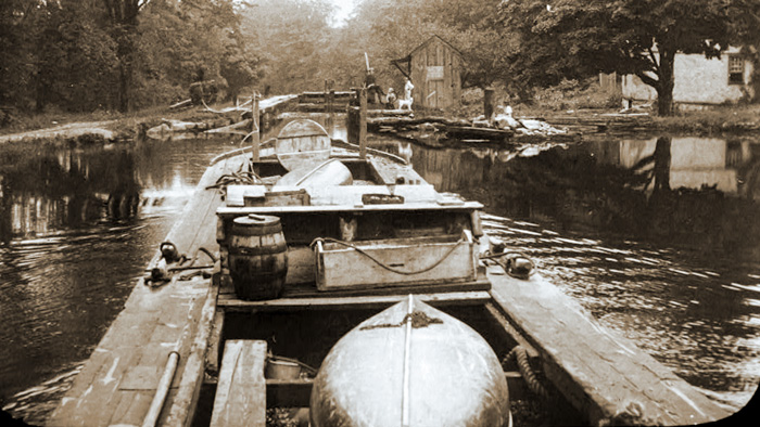
| 33 | Plane 9 WestRoute 519, Phillipsburg |
The former plane tender’s house is now the Jim and Mary Lee Canal Museum. Walk around the property to see remnants of the inclined plane, displays of canal artifacts found there, and the low tailrace tunnel into the turbine chamber. More... |
| 34 | Bread Lock Park2627 Route 57 East, Stewartsville |
The park at the site of Lock 7 West contains the remains of the canal prism and lock tender’s house, a former mule barn, a life-size replica of a canal boat, and the Warren Heritage Museum. There are trails for hiking and biking, an exercise trail, and a storybook walk. More... |
| 35 | Port Murray Preserve21 Hoffman Road, Mansfield Twp. |
A Morris Canal boat basin, a former canal store and a section of the towpath for walking, make it easy to picture the canal in its heyday. |
| 36 | HackettstownGrand Avenue & Harvey Street |
Visitors can stroll the towpath where the canal runs through a wooded area at Florence W. Kuipers Memorial Park & Rockport Wildlife Management Area. |
| 37 | Saxton FallsStephens State Park, Hackettstown |
A two-mile section of towpath proceeds along visible canal artifacts as well as scenic views of the Musconetcong River. The trail runs along Waterloo Road and then to ruins of a sawmill remain and a lime kiln next to it. Nearby is the site of Lock 4 West and the lock tender’s house. This section of the canal also contains Saxton Falls, where remnants of one of the canal’s 28 locks are visible. |
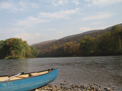
| 38 | Delaware River |
Points from Poxono in the National Recreation Area to Phillipsburg offer canoeists and kayakers abundant access to the longest free-flowing river in the eastern U.S. Moderate skills are generally required with the exception of Foul Rift, near Belvidere, which deserves a special word of caution. More... |
|---|---|---|
| 39 | Musconetcong River |
The Musky ranges from calm and wide to quick and narrow as it flows along Warren County’s southern border from Tilcon Lake to the Delaware River through an ever-changing landscape. Paddlers, who can put in at points along the entire length the river, must be aware of still-existing dam locations, and wary of the skeletal remains of more dams that hide just beneath the water’s surface. More... A Waterway Trail Guide is available at the Musconetcong Watershed Association River Resource Center in Asbury. |
| 40 | Paulins Kill,
|
The best Skylands white-water paddling is generally in early spring on the Paulins Kill or Pequest. Conditions will depend on water level and, while Class III and even IV rapids can be found on occasion, these rivers can usually be relied on to offer a few interesting stretches. More.... |
| 41 | Tilcon LakeKinney Rd between Waterloo Rd and Waterloo Valley Rd, Hackettstown |
Anglers can now hunt salmon averaging eighteen inches in this old quarry near the Musconetcong River, now part of the state park system. For kayakers, there are two islands and many coves to explore. |
| 42 | Ghost LakeJenny Jump State Park Shades of Death Road |
Accessible from for car top boat launches, the lake offers great bass fishing before it is overtaken by weeds each year. |
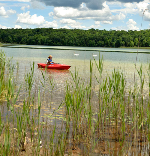
| 43 | Mountain Lake |
A residential community surrounds this natural glacial lake at the edge of Jenny Jump State Park, but there is visitor access for paddlers and fishermen who often come in search of stocked muskellunge. More... |
| 44 | Furnace LakeOxford |
|
| 45 | White LakeStillwater Rd (Rt. 521), Blairstown |
|
| 46 | Delaware LakeDelaware Rd. (Rt 605), Knowlton Township |
One of only three in the state designated as “lunker bass lakes”, this 36-acre pond offers a car-top launch for small, electric-powered boats or for kayakers wishing to explore the forested banks and abutting marshland. |
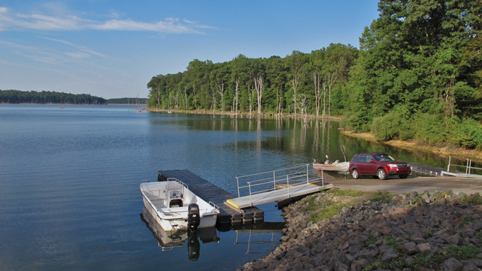
| 47 | Merrill Creek Reservoir34 Merrill Creek Road Washington 908/454-1213 www.merrillcreek.com |
|
| 48 | Fixed Wing Aircraft |
Small plane and glider flights are available at Blairstown Airport for quick and easy access to the broad vistas over the Kittatinny Ridge and Delaware Valley. |
|---|---|---|
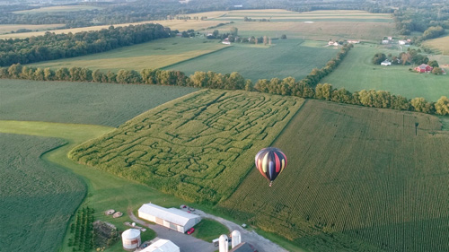
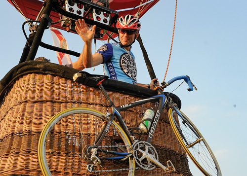
| 49 | Hot Air Balloon |
Recreation is like a medicine — “re-creating” focus and energy. Ballooning is recreation for the spirit, a medicine that really works!. The breathtaking panorama- farms, woods, lakes, rivers, deer, horses, dogs, backyards, decks, people working, people playing, architecture, the Delaware Water Gap and the setting sun. A study in improvisation, a balloon flight is worth your while. Check the Explore Warren County Tourism Partnership for hot-air balloon services. |
| 50 | Balloon and a Bike! |
|