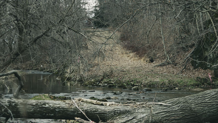
Lopatcong Creek pours down the Scotts Mountain Ridge in Harmony Township towards its appointment with the Delaware River twelve miles southwest at Phillipsburg.
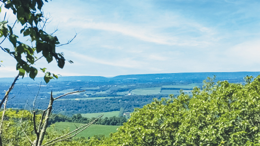
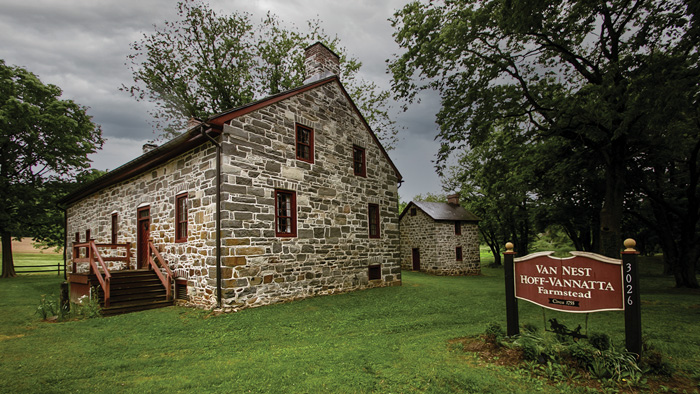
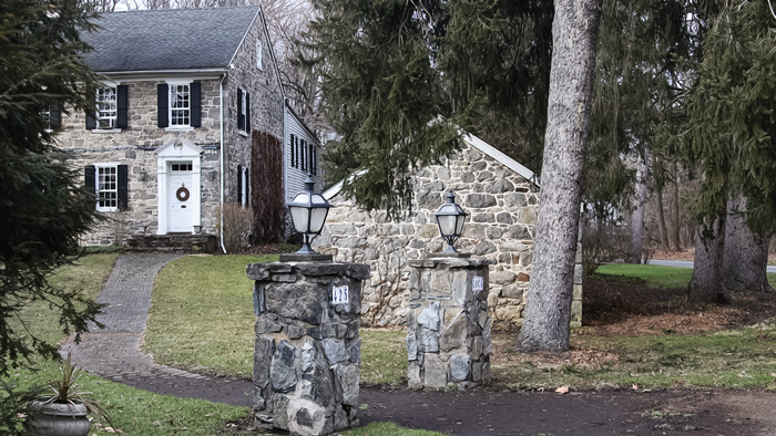
Hikers can explore the upper reaches of the Lopatcong along portions of the Warren Highlands Trail, crossing farms and rugged forest through the peaks and valleys of the watershed. From the access on Ridge Road, a woods road leads to a 1.8-mile ascent to a spectacular viewpoint at Ragged Ridge, also significant in Native American history as vantage point for signaling to other prominent ridges in the Delaware Valley. The trail diverges from the creek’s general path downhill as it points west towards the historic Van Nest-Hoff-Vanatta Farmstead on County Route 519. Reflecting three centuries of agricultural practices and rural architecture, the farmstead exemplifies the township’s heritage clearly expressed here and throughout the Lopatcong Valley. The trail then loops back towards the northwest edge of Merrill Creek Reservoir, crossing Lopatcong Creek near the Miller Farm access on Harmony Brass Castle Road.
At the base of Scotts Mountain, Lopatcong Creek turns south through the valley, where Route 519 follows its alignment past the Warren County Farmers’ Fairgrounds. Generations of fairgoers have crossed the creek on the little wooden bridge at the entrance to the Warren County Farmers’ Fair. Over its long history the agricultural ambiance of the annual exposition has remained, while the excitement of tractor pulls, mud bogs, demolition derbies and carnival rides keep the attention of a wider audience. And for twenty-one years, the companion Hot Air Balloon Festival has brought growing awareness of the beauty of the Lopatcong Valley.
The Lopatcong watershed hosts the remnants of locks and planes at the western terminus of the Morris Canal, which are preserved and documented by the ever-expanding Morris Canal Greenway project. The creek drifts below State Route 57 and approaches the site where its waters once combined with the canal at the bottom of Plane 9 West at Port Warren, the longest of twenty-three inclined planes that conquered an unprecedented 1,674-foot change in elevation along the canal’s journey from Phillipsburg to the Hudson River at Jersey City. A visit to the Jim and Mary Lee Museum includes a walk around the property to see remnants of the inclined plane and a trip through the low tailrace tunnel into the chamber which contains a rare instance of the innovative turbine machinery that distinguished the Morris Canal from all others.
The creek continues west near the old canal bed that it once inhabited. Part of the Greenway, the towpath strides across the field through clumps of trees and the remains of a canal waste weir. West of Strykers Road the creek enters urbanity as it skirts a warehouse complex and ducks under Route 22 towards Lock Street in Phillipsburg. Always vital to the canal’s operation, the creek ran close, and sometimes joined this 1.2-mile stretch where another inclined plane and three locks lifted boats from the Delaware seventy-one feet in elevation from the Delaware River to the plateau of farmland to the east. Reserve an afternoon for a walk down Lock Street, which has been rerouted over the buried remnants of the canal. With the help of Greenway kiosks, and perhaps a live phone link to online documentation, you’ll notice the canal bridges, remains of Plane #10 West, and historic canal-era homes linked from past to present by the flow of the Pohatcong Creek.
The commanding five-span stone arch Green’s Bridge towers over both the creek and South Main Street near the site of another historic canal lock. Just beyond, where the creek once again combined with the canal, another Greenway outpost documents more industrial heritage in a grassy area between the busy road and the creek. It covers the remains of the former Shimer Mill complex and mill pond that stored overflow from the creek to power other mills downstream. Beyond Millpond Park, Pohatcong Creek veers away from the canal trail and sneaks under railroad tracks into the Delaware.
Continue to explore Phillipsburg’s transportation heritage at the Port Delaware Canal Arch or take a ride on historic railroad equipment along the Delaware River Railroad Excursion to points south. Or rejoin the Warren Highlands Trail at the Northampton Street Bridge and follow North Main and River Road (Rt. 621) north out of town to the Marble Mountain Natural Resource Area. Near the top of Marble Mountain is the “ice cave,” actually the former Fulmer iron mine, with an intriguing array of ice stalagmites that form when the air is cold enough to freeze the dripping water inside. Four miles of trails through upland deciduous forest offer views across the Weygadt Gap to a Pennsylvania rock formation called St. Anthony’s Nose that towers over the opposite riverbank.
PhillipsburgMarket Street off South Main Street |
A section of greenway with informational kiosks includes the stone arch that marked the entrance to the canal at the edge of the Delaware River. |
Plane 9 WestRoute 519, Phillipsburg |
The former plane tender’s house is now the Jim and Mary Lee Canal Museum. Walk around the property to see remnants of the inclined plane, displays of canal artifacts found there, and the low tailrace tunnel into the turbine chamber. More... |
Bread Lock Park2627 Route 57 East, Stewartsville |
The park at the site of Lock 7 West contains the remains of the canal prism and lock tender’s house, a former mule barn, a life-size replica of a canal boat, and the Warren Heritage Museum. There are trails for hiking and biking, an exercise trail, and a storybook walk. More... |
Port Murray Preserve21 Hoffman Road, Mansfield Twp. |
A Morris Canal boat basin, a former canal store and a section of the towpath for walking, make it easy to picture the canal in its heyday. |
HackettstownGrand Avenue & Harvey Street |
Visitors can stroll the towpath where the canal runs through a wooded area at Florence W. Kuipers Memorial Park & Rockport Wildlife Management Area. |
Saxton FallsStephens State Park, Hackettstown |
A two-mile section of towpath proceeds along visible canal artifacts as well as scenic views of the Musconetcong River. The trail runs along Waterloo Road and then to ruins of a sawmill remain and a lime kiln next to it. Nearby is the site of Lock 4 West and the lock tender’s house. This section of the canal also contains Saxton Falls, where remnants of one of the canal’s 28 locks are visible. |
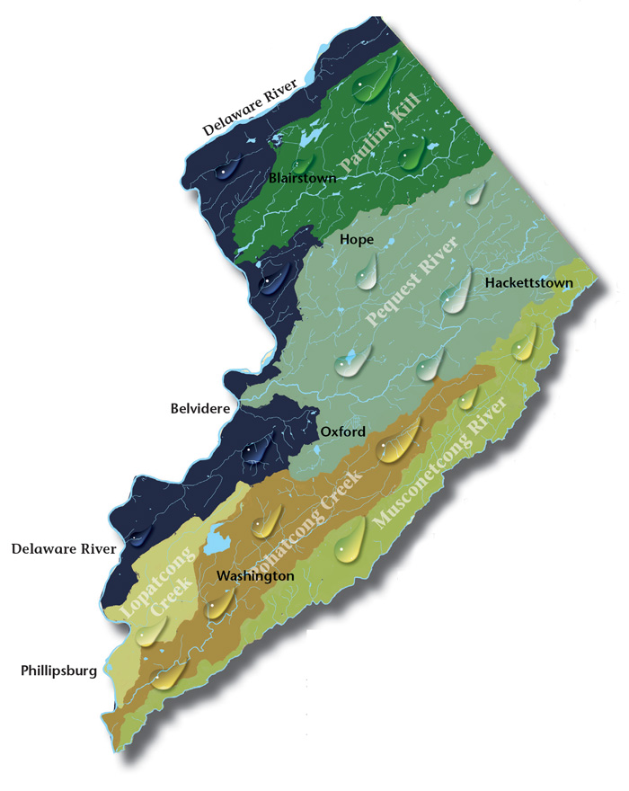
Paulins Kill Valley. The river flows north from its source near Newton in Sussex County, and then turns southwest toward the Warren County townships of Frelinghuysen, Hardwick, Blairstown, and Knowlton.
Pequest Watershed. The Pequest River begins in Sussex County and flows thirty-two miles to where it meets the Delaware in Belvidere, Warren’s county seat.
Pohatcong Creek. Following Pohatcong Mountain, another of the many Appalachian ridges that run through Warren County, the Pohatcong Watershed lies parallel and between those of the Musconetcong River to the south and the Pequest to the north.
Musconetcong Valley. Forming the southern Warren County border, the big river runs forty-two-and-a-half miles through a wide valley flanked on the northwest by the Allamuchy and Pohatcong mountains, and Schooley’s and Musconetcong mountains to the southeast in Morris and Hunterdon counties, twisting and turning over the ruins of our past.
The Centenary Stage Company produces professional equity theatre and also a wide variety of top-flight musical and dance events throughout the year.
Local roots!
Millbrook Village, part of the Delaware Water Gap National Recreation Area, is a re-created community of the 1800s where aspects of pioneer life are exhibited and occasionally demonstrated by skilled and dedicated docents throughout the village
Consider Rutherfurd Hall as refuge and sanctuary in similar ways now, as it served a distinguished family a hundred years ago.
Choose and Cut from 10,000 trees! Blue Spruce, Norway Spruce, White Pine, Scotch Pine Fraser Fir, Canaan fir, Douglas Fir. Family run on preserved farmland. Open Nov 29 - Dec 23, Tues-Sunday, 9-4. Easy Access from Routes 78 or 80.