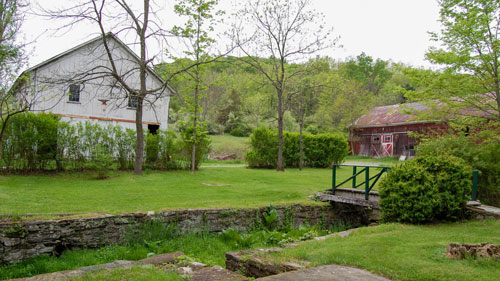
I meet Larry Wheelock, New York/New Jersey Trail Conference trails director, at the Pochuck Quagmire Bridge and boardwalk in Vernon Township. The boardwalk is a recently built section of the Appalachian Trail (AT) that provides a safe alternative to dodging road traffic on Rt. 517, once the only way to get from Pochuck Mountain to the trail on Wawayanda Mountain. And for those out for a fun stroll, it's a great opportunity to enjoy a walk over wetland and streams in the northernmost reaches of Sussex County.
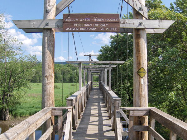
The serpentine walk is low and narrow through the floodplain. The trail is skinny and unobtrusive with scattered benches good for watching hawks and herons. It slinks through cattails, above grasses and wildflowers dotted with shrubs and edged in woods. Wawayanda Mountain forms a ridge across the valley to the east.
Wheelock says that every board and all materials for the boardwalk were hand-carried in except for one time when a helicopter dropped materials. After Hurricane Floyd flooded the first stretch of the boardwalk, volunteers worked by rowboat. The hardest part of building the boardwalk was hauling and sinking almost 900 metal piers to hold it up.
Wheelock says that 10 percent of the 1.5-mile boardwalk use is by AT thru-hikers and section-hikers. The other 90 percent of the traffic consists of locals--joggers, dog-walkers and school kids doing nature studies. There is nothing on the AT that is as much like a community park as this is. On this day, one woman comes by with her dog. She's here all the time. She says it's nice because she has a place to walk and doesn't have to worry about traffic. They cross the 110-foot Pochuck Quagmire Suspension Bridge over Pochuck Creek and continue on their peaceful, easy journey.
The AT relocation was a joint effort of cooperating federal, state and local governments, private organizations and volunteers. It began in 1980 when the DEP and National Park Service started buying the needed land as buffer for the AT. "They bought the corridor and then the question was, 'how do we get across it?'" says Tibor Latinscics, bridge project engineer. Before now, with the completion of the boardwalk, hikers did an extra 2.1 miles on roads to get around Pochuck Creek and the 3,000-foot wide wetland that becomes a lake when the creek floods. Latinscics says there are three words for the project: inspiration, perseverance and perspiration. "You had to be there about 15 years ago, knee deep in water with no budget. We had this vision. It was ten seconds of inspiration and ten years of perseverance to gather partners and funding."
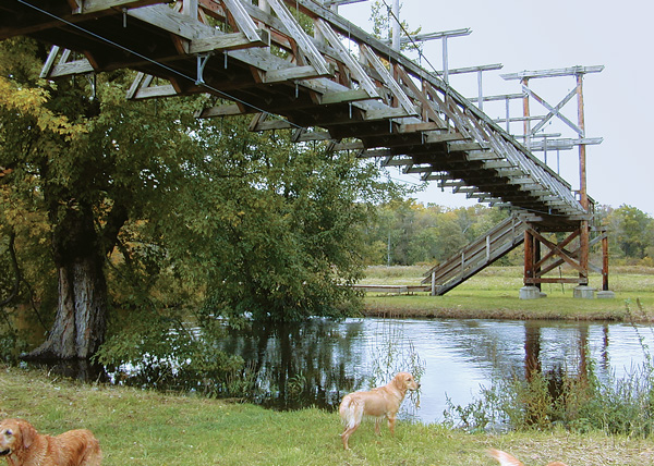
Latinscics designed the bridge using his daughter's baby food jars for the model in 1989. As the project gathered steam and GPU stepped in as a partner, he redesigned it using a sudden stockyard of resources. Funding for the project escalated as people went to the floodplain to see the suspension bridge. "You walk out there and there's this dinosaur sitting out there in the swamp," he says. "Initially, we just wanted to get over the creek." The Pochuck Quagmire Bridge over Pochuck Creek on the AT was completed in 1995.
When the bridge was up, it became a high profile project and more money flowed in to build the boardwalk. Wheelock rounded up the 350 volunteers to complete the boardwalk three years ago. It was dedicated last summer, and both bridge and boardwalk are maintained by the New York/New Jersey Trail Conference.
The amazing thing Latinscics finds about the bridge is that it's worth $400,000, but cost only $36,000 in materials, thanks to the voluminous hours of volunteer man and womanpower.
The floodplain is designated by the DEP as an "Exceptional Resource Value Wetland" because it provides habitat for endangered and threatened plant and wildlife species like Cooper's hawk, barred owl and wood turtles and over 200 species of birds. It's a great place for wildlife viewing. "The area close to Rt. 517 in the morning is great if you're a bird watcher," says Latinscics. "I've never not seen a hawk overhead. It's amazing."
One and one-quarter hours of serenity can be yours. The walk is easy and varied, with a lot to see. For information call NY/NJTC at 201- 512-9348, or online.
To get there: For a round-trip three mile walk, take Route 517 or Route 94 to Canal Road. Drive north to the AT parking lot on the left. Walk a little north, then west on the white blaze trail to the boardwalk. For a one-way five mile hike, park one car roadside on 517 south of Carol Drive and another car in the AT lot on 94, just south of Prices Switch Road.
“The Fluorescent Mineral Capitol of the World" Fluorescent, local & worldwide minerals, fossils, artifacts, two-level mine replica.
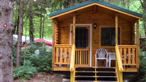
Located in Sussex County near the Kittatinny Mountains the camping resort offers park model, cabin and luxury tent rentals as well as trailer or tent campsites with water, electric and cable TV hookups on 200 scenic acres.
Follow the tiny but mighty Wallkill River on its 88.3-mile journey north through eastern Sussex County into New York State.
Peters Valley shares the experience of the American Craft Movement with interactive learning through a series of workshops. A shop and gallery showcases the contemporary craft of residents and other talented artists at the Crafts Center... ceramics, glass, jewelry, wood and more in a beautiful natural setting. Open year round.