How have we loved the Musconetcong River? Let us count the ways.

First, we (that is, human beings) loved its water and its fish and the fact that big herbivores drank from it, sometimes failing to notice us as we crept up on them with our bows and arrows, and, later, with guns.
Second, we loved it for its power. We loved it for turning the wheels on grist mills and powering iron forges. We loved it because this power allowed us to build forges and factories and farms and lives in the days when water power was pretty much all we had, aside from muscle power.
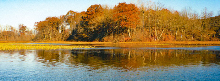
Finally, and maybe from the very beginning, we loved the Musconetcong River because it was, and is, beautiful, and so is the valley it flows through, from Lake Musconetcong on the north to Rieglesville at the confluence with the Delaware River.
So, how is our old love doing these days? As it turns out, not bad. First, full disclosure is in order. I live on a bluff above the river in Hackettstown, and I love the Musconetcong River. Every warm night for 14 years, the sound of the river rushing around two sharp bends below my house has been one of the first things I've heard when I woke up, and one of the last things I've heard before I went to sleep. I've swum in it, fished in it, hiked along it and fallen into it. The same can be said for most of my neighbors. Indeed, the same can be said for a very high percentage of the people who live in its valley. This is not the Whippany, or the Rockaway, which people mostly drive over and ignore. No, this river is loved.
Unlike the Black River, which bubbles almost apologetically out of the ground and trickles under a highway, the Musconetcong gets a running start coming out of Lake Hopatcong , then into Lake Musconetcong. From Lake Hopatcong, it twists and turns over the ruins of the Industrial Revolution, dividing Warren County, on its west bank, from Morris County. Those ruins aren't as extensive as they are on, say, the Rockaway, for the simple reason that there wasn't as much industry. The biggest single industrial artifact along the river is the Morris Canal.
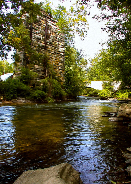
From its completion in 1831 until the railroads put it out of business, the Morris Canal ran from Phillipsburg to Jersey City, carrying coal and iron to feed the forges in places like Wharton, Dover, Rockaway and Boonton. It ran parallel to the Musconetcong, along its west bank, as far as Lake Hopatcong. Today, the canal is visible as a sort of trench between the river and Waterloo Road. In some spots, the trench has filled in, but the ground is still lower than either the river bank or road bed. When the river is high, these spots become little swamps, and sometimes, the river seems to take them over altogether. At Waterloo Village, just north of Hackettstown in Byram Township, there is a 19th-century canal town, complete with blacksmith shop, grist mill and general store; a restored farm, with livestock, centered around an 1825 farm house, and a restored Lenni Lenape village, exhibiting dwellings, tools weapons and other objects of interest. The Musconetcong Valley is, in fact, home to a relatively high density of sites relevant to modern American society; and it is gratifying to know that communities like Hopatcong, Stanhope, Hackettstown and Beattystown all have roots over 250 years old. Moreover, men have been walking (and fishing) in this valley for 10,000 years!
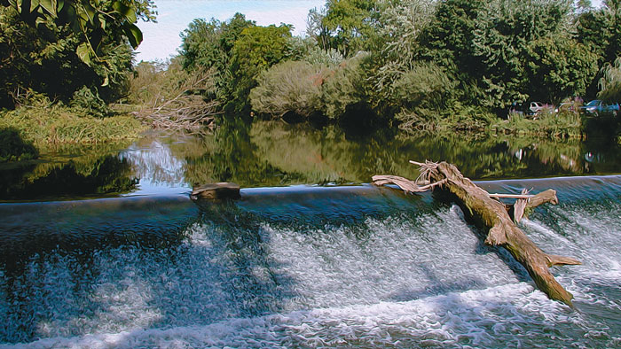
Access to the river is easy along Waterloo Road (Route 604, and in spring and fall, the road is lined with the cars of fishermen, who usually have only a few yards to walk to find a promising spot. The river skirts Waterloo Village's southern edge where it is heavily stocked, but not necessarily heavily fished, at least after the stocking season has ended. The trout become very selective and begin feeding on a natural diet. Fishermen must go light, using light tippets and flies that imitate aquatic insects. After the river runs under Route 80 there is a stretch that is rarely stocked; a prime beat of river that sees very few fishermen. If you'd like to try for some really big trout, some of the pools back here may be just the ticket.
Past Waterloo Village and the Route 80 bridge the river comes out to the road and is fishable southwest through Stephens State Park. One notable location here is the eternal Saxton Falls. The scene on opening day is trout fishing mayhem, but the falls become serene as the season progresses and you are more likely to find yourself alone. Natural bait, artificial flies and lures catch fish year round. You can always count on a persistent rock bass or sunfish to rise on a fly or two when the trout aren't interested. And, believe it or not, eels make their way all the way up here from the ocean to this waterfall! Below Saxton Falls and through Stephens State Park the river's regular stocking gets a bonus of giant trout from private clubs who donate fish in excess of 20 inches in length. These big fish holdover well and are occasionally caught on into late fall and winter.
The river runs through Allamuchy Mountain State Park, and its smaller cousin, Stephens State Park which means that much of the land immediately adjacent to the river, especially on the Morris County side, is protected. Except for Waterloo Village and the area around the Saxton Falls dam, however, much of the land on the Warren County side is occupied by small homes. When the river takes an eastward bend, roads lead to small clusters of eclectic houses on small wooded lots. After you reach Hackettstown, you pass the House of the Good Shepherd, a retirement home, on the riverbank. Just after that, you come to Rustic Knolls, where I live and move and pay my taxes. This is where I do most of my fishing, swimming and falling in. There are 48 houses in the Knolls, most of them now year-round.
It's near Hackettstown that you can see the full sweep of the river valley. Coming west on Route 46, down the hill from Budd Lake, you reach an opening in the trees on the downslope side and see the whole Musconetcong Valley laid out before you. Mountains recede into the distance on either side, and in the middle are farms, forest, and a church spire or two. It's this part of the valley that has been the focus of intense preservation efforts in the past few years, and those efforts may have paid off.
Lots of people love the river, and lots of people work hard to keep it healthy. But John Brunner actually gets paid to keep it that way. He doesn't get paid much, but he manages to keep body and soul more or less together and put gas in his much-abused, much-lived-in car. Brunner is the executive director of the Musconetcong Watershed Association, a non-profit organization charted in 1992 to "enhance and protect" the river and everything that flows into it. He and his colleagues are leading an effort to have the lower Musconetcong (roughly from just south of Hackettstown to the river's mouth at Rieglesville) declared a "wild and scenic river". The term is a bureaucratic one; the river may be scenic, but it hasn't been wild in a long, long time. Such a designation would put the watershed's health at the top of the list when development decisions are made in the valley though, as Brunner is quick to point out, land now private would remain in private hands. The focus of the MWA's effort now is to get all 14 municipalities along the river to endorse the designation, and the plan the MWA has put together for implementing it. Eleven have endorsed it so far.
Brunner is a tree-hugger (more of a water kisser, actually), but he is an individual piece of work. He has no deep philosophical problems with development or developers; it's what they develop, and how, that concerns him. "The biggest threat to the river is commercial development," he says. "Parking lots, impermeable surfaces, things that make for lots of run-off. The best defense is to have the municipalities get their act together, to have the best possible zoning and land-use ordinances."
Brunner cares less about McMansions going up in the next watershed than he does about a custom-built home with its driveway sloppily hacked out near a tributary stream. "Now, that is a gross hack job," he says, looking at one such driveway. "We'll have to do something about that." Brunner takes photos of the driveway, and makes a note to call the township authorities about it.
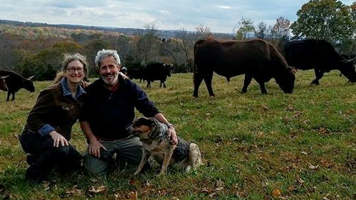
Ninety percent of the lower valley is farmland, and most of it has been preserved, according to Brunner. This has been a great boon for the river, Brunner says, but again, it's how a farm is run that matters. "This will sound like heresy, but in some cases, a given farm, turned into a subdivision, can be a wash," he says. As he drives along the river, he points approvingly to farms whose owners have left a green buffer between themselves and the river, and scowls at those whose crops grow within a few feet of its bank.
If the river looks anywhere as it looked a century or more ago, it looks that way on its lower third, where it divides Warren County, on the west bank, from Hunterdon County. From just west of Route 31 until it runs into the Delaware at Rieglesville, the river is less approachable, but worth approaching. To reach this part of the river, start at the intersection of routes 632 and 31; follow Route 632 west. The river will be on your left, and you'll want to make whatever turns you need to make in order to keep it in view.
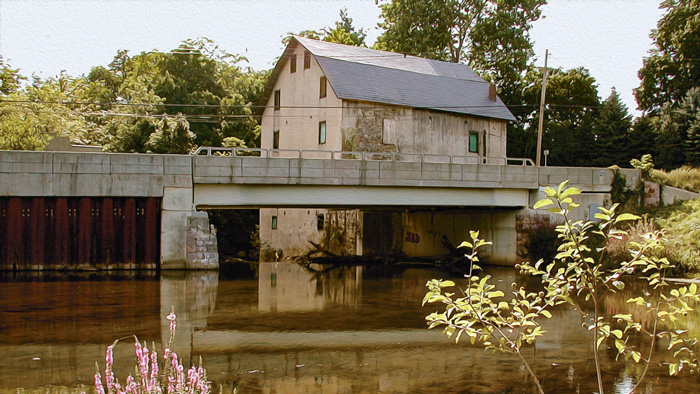
On the Warren County side of the river, you'll pass through Asbury, named for Methodist Bishop Francis Asbury, the founder of Methodism in America. Asbury is full of Georgian, Federal, Greek Revival and Victorian buildings. Like every other little town in the eastern United States whose development pre-dates the automobile, Asbury calls itself "historic". However, unlike many of those other towns, Asbury really is historic in a quiet, everyday way. It was built in the late 18th century around several gristmills, the remains of which are not difficult to find. Brunner's office will soon be in one of them, right on the river bank.
There are innumerable little bridges on this stretch of the river, many of which accommodate only one vehicle at a time. Cross over one of them below Asbury, and you come to Bloomsbury on the Hunterdon County side. Bloomsbury has a railroad and turnpike heritage, an iron-truss bridge and the general look of having been carefully preserved. By the time you get to Finesville near the obligatory gristmill and also featuring an iron-truss bridge the air of preservation is particularly thick. The village is tiny, and it has several substantial stone houses built close together. Get there early on a misty morning, before people are up and about, and you can't help expecting elves to emerge from the houses and trolls from under the bridge.
The mouth of the river is a piece of good news/bad news. The good news is that Route 627 leads you to Rieglesville (NJ and PA) and a century-old truss bridge across the Delaware River. This bridge barely allows two Toyotas to cross at the same time, and the speed limit, quite properly, is 20 miles per hour. You can walk across, and it's probably better if you do. John Roebling, who completed the Brooklyn Bridge in 1883, did this one, probably over a long weekend, 20 years later.
The bad news is, you have to cross the bridge to see the mouth of the Musconetcong, unless you belong to the private club that controls access to the mouth. Once you've crossed to Pennsylvania, you can see the Musconetcong pour into the larger stream about a quarter mile downstream from the bridge. The Musconetcong joins the big river, carrying with it the residue of everything we've done in it, near it or to it. The Delaware adds this to its already heavy load, and carries it away.
Artisanal cheeses, wood fired breads, 100% grass-fed beef, whey fed pork, and suckled veal, 100% grass-fed ice cream, pasta made with Emmer wheat and our own free-range eggs, and pesto made with our own basil! Bread and cheesemaking workshops are held on the working farm as well as weekend tours and occasional concerts.

Delightful fantasies beyond words! Gold, Platinum & Silver Jewelry, Wildlife Photos, Crystal, Lighthouses. Perfume Bottles, Santas, Witches Balls, Oil Lamps, Paperweights, Chimes, Art Glass, Wishing Stars. Also offering jewelry and watch repair